
File:DRR line map.png
No higher resolution available.
DRR_line_map.png (796 × 420 pixels, file size: 111 KB, MIME type: image/png)
Summary
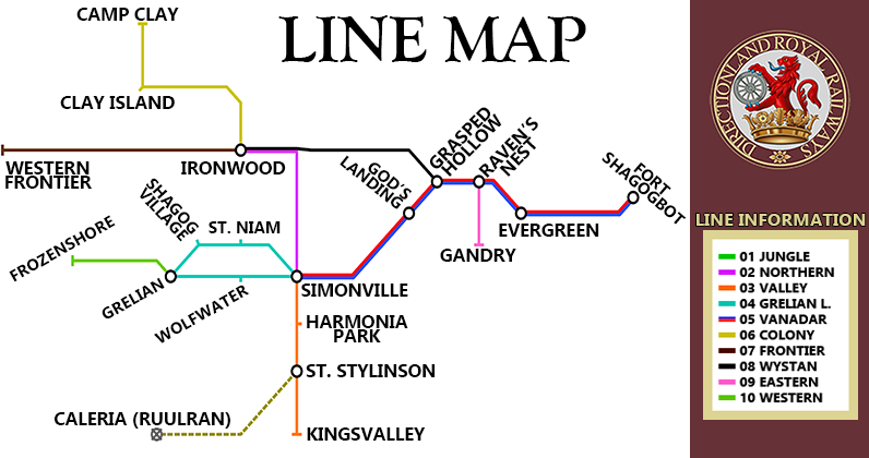
Line map of the Directionland Royal Railways network.
File history
Click on a date/time to view the file as it appeared at that time.
| Date/Time | Thumbnail | Dimensions | User | Comment | |
|---|---|---|---|---|---|
| current | 23:18, 29 October 2025 | | 796 × 420 (111 KB) | Lukile (talk | contribs) | |
| 08:59, 29 October 2025 |  | 1,547 × 920 (1.53 MB) | Rivekis (talk | contribs) | Line map of the Directionland Royal Railways network. |
You cannot overwrite this file.
File usage
The following page uses this file: